0
Skip to Content
Greentown Ohio Cemetery
Home
About
Contact
Find a Grave
Lot Map
Rules & Regulations
Open Menu
Close Menu
Greentown Ohio Cemetery
Home
About
Contact
Find a Grave
Lot Map
Rules & Regulations
Open Menu
Close Menu
Home
About
Contact
Find a Grave
Lot Map
Rules & Regulations
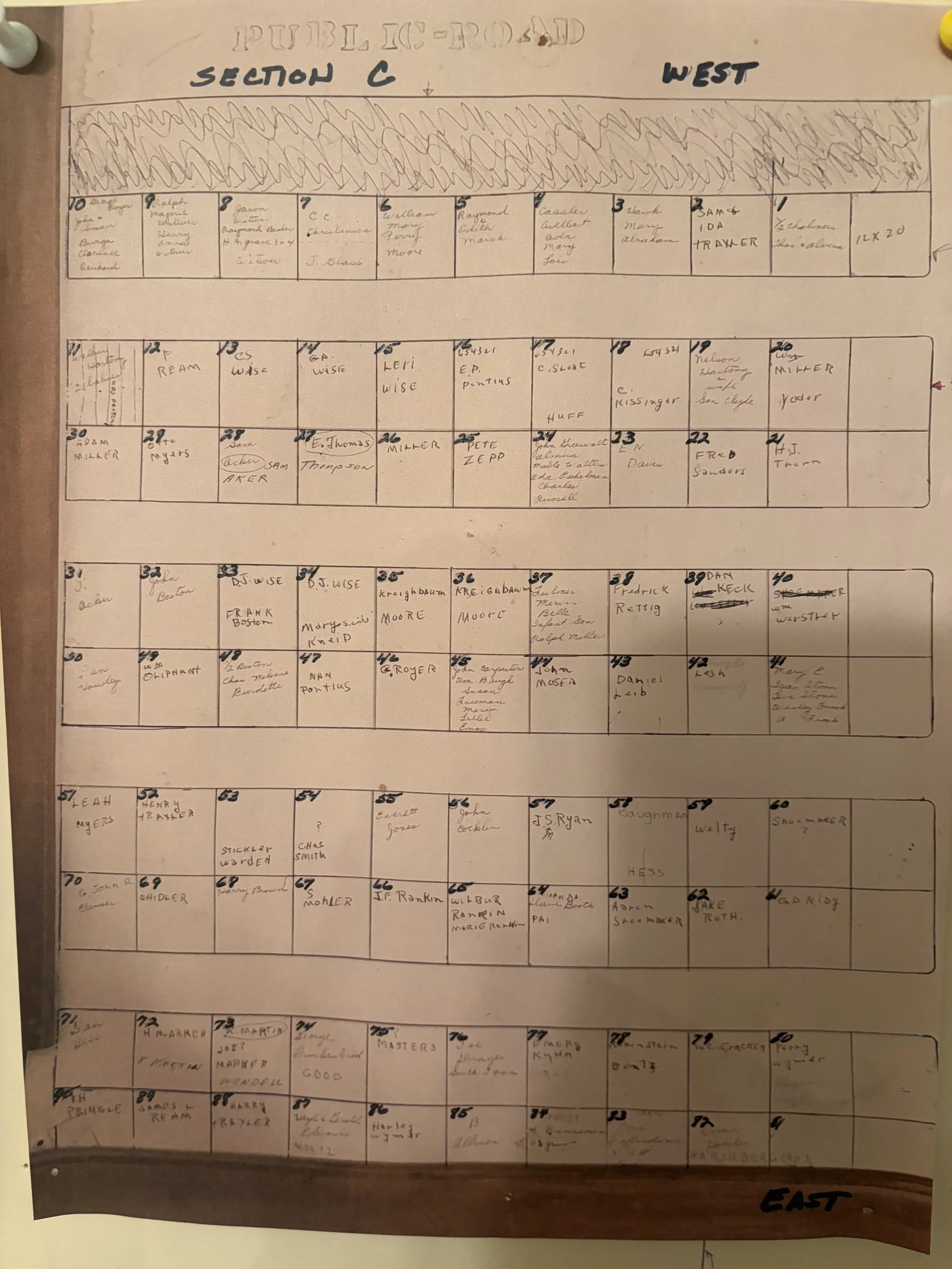
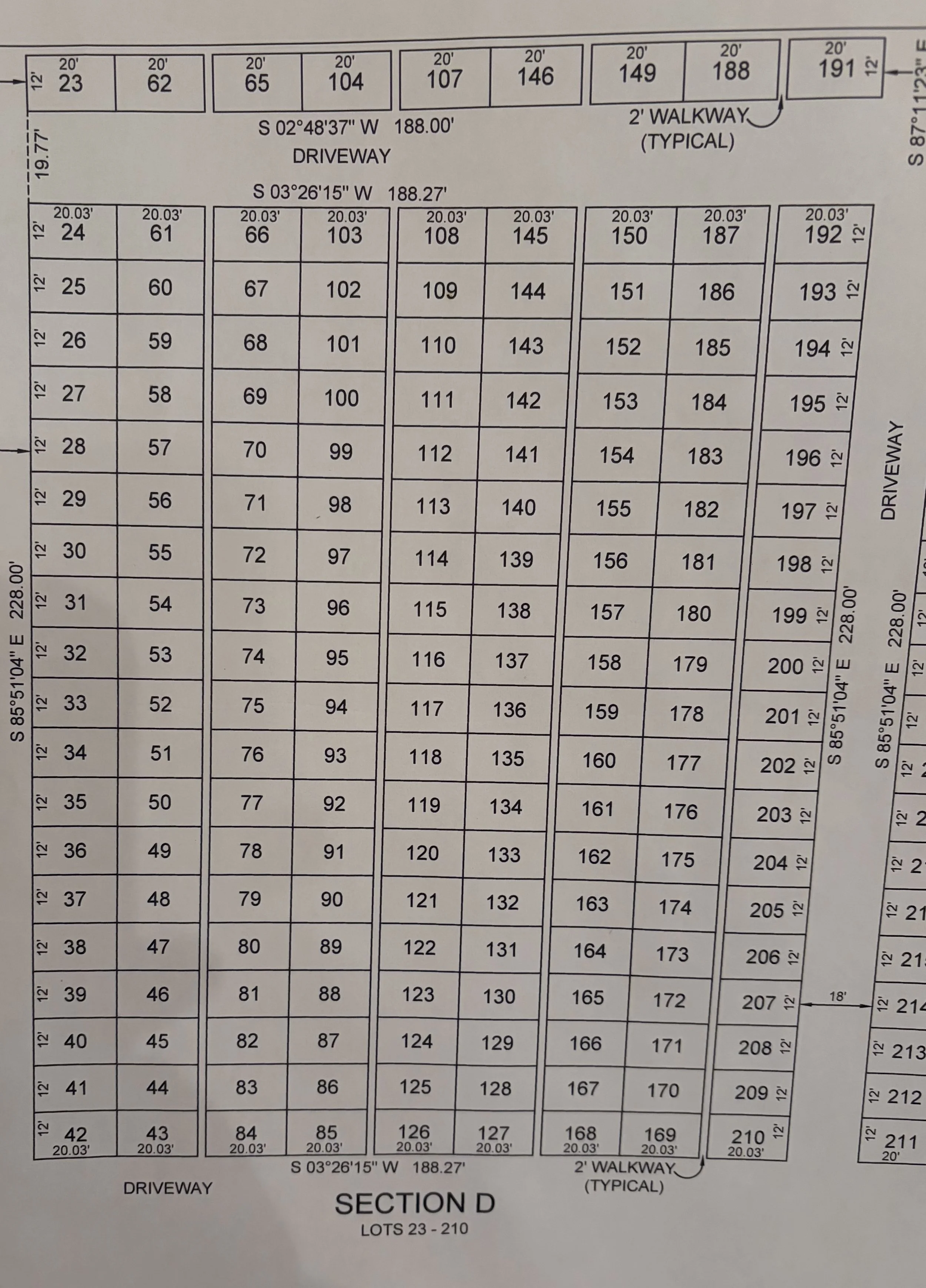
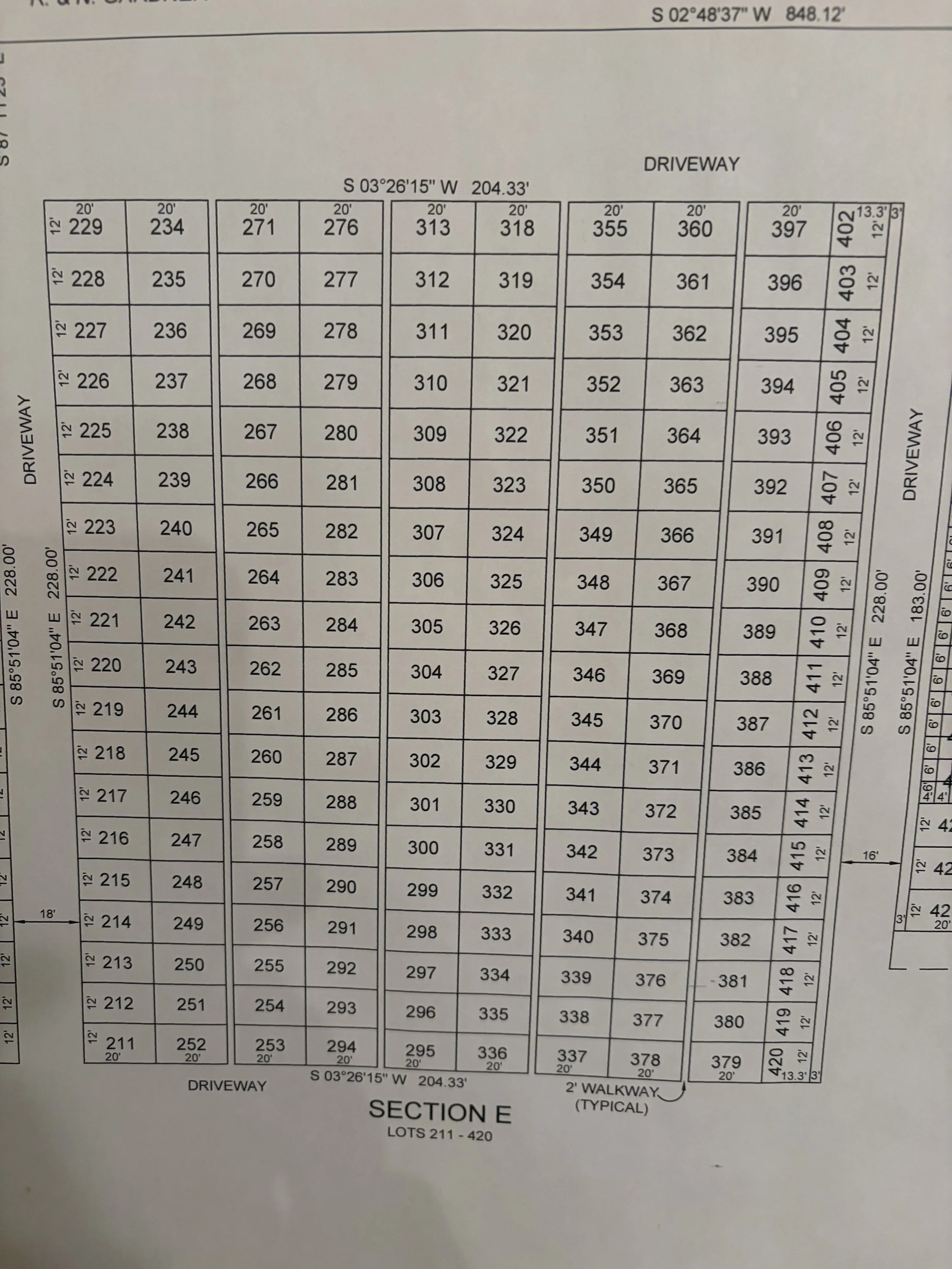
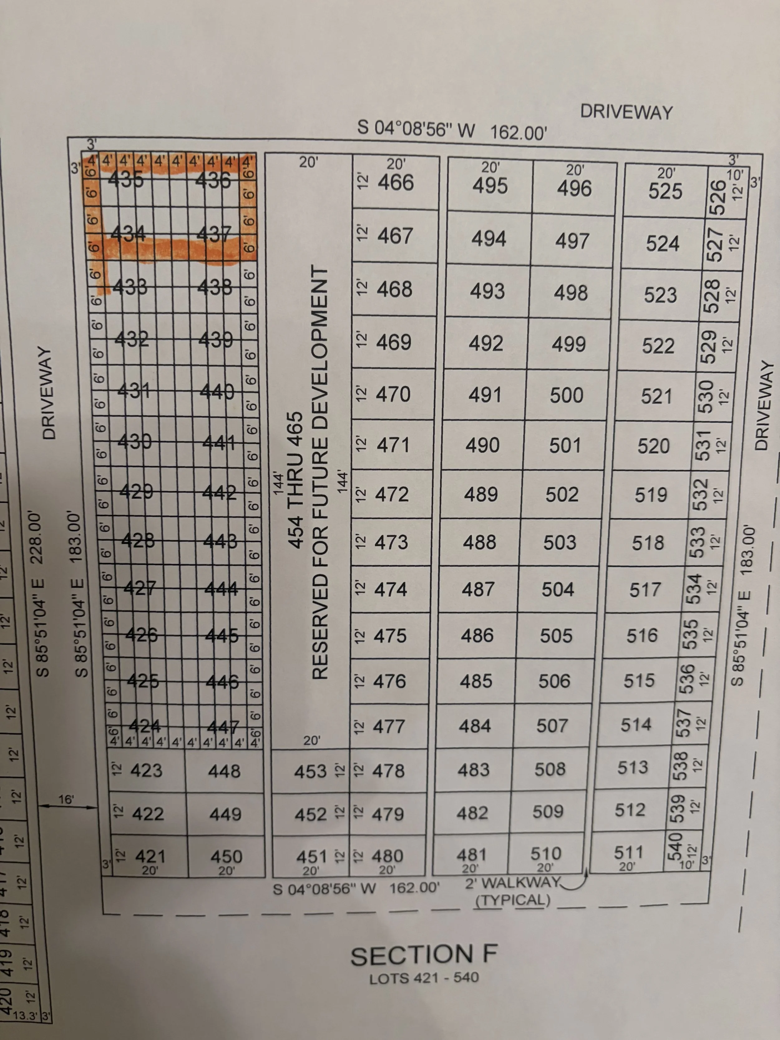
Lot Map